A bird’s-eye view would
show the county to be divided into two parts of nearly equal size, but
of totally different aspects. As a whole it is very diversified,
embracing districts that are entirely of a Highland type of scenery,
while in the south and east the lowland and the maritime type
predominate. In appearance it resembles Forfarshire, which, however,
excels in extent and boldness of mountain summits.
The two main divisions of the county may be further regarded as being
naturally sub-divided into four longitudinal and parallel districts: the
Maritime, the Howe, the Grampian, and the Deeside. The Grampian district
stretches through the whole breadth of the county from west to east, and
is on an average from 16 to 18 miles in length and from 6 to 8 miles
across from south to north. It is naturally rugged, sterile, and dreary.
Its total area may be reckoned at 120 square miles, mostly moor and
heather. From Mount Battock (2555 ft.) in the north-west, the highest
peak in the district, the Grampians gradually descend and are popularly
regarded as terminating in the low heights (about 200 ft.) near the Bay
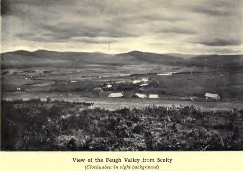
of Nigg. Of the other Grampian peaks the most prominent are Clochnaben
(1944 ft.), with its granite knob 100 ft. high, a well-known landmark
from the sea; Kerloch (1747 ft.), and Cairnmonearn (1245 ft.). The Hill
of Fare on the north side of the Dee reaches a height of 1429 ft., while
on the opposite side of the river, Scolty Hill (982 ft.), with its
monument to General Burnett, is a notable landmark, from which, as from
the top of most of the hills, splendid views are obtainable of the
scenery of Aberdeenshire on the north, and of the Howe on the south.
The Deeside district extends westward from the mouth of the Dee along
the southern banks of that river for 23 miles, and has an area of about
54 square miles. There is also a portion of this district on the north
bank of the Dee above Banchory, extending to about 26 square miles.
Although, as regards agriculture, Deeside is a comparatively poor
region, yet there is in it a greater proportion of surface under timber
than in any other part of the county. This gives it a very pleasing
aspect, embellished as it is by the waters of the “ Silvery Dee,”
flowing along through the level haughs and meadows that lie between the
encircling slopes on both sides of the valley. .
The Howe of the Mearns district, about 16 miles long, 5 miles broad, and
having an area of about 50 square miles, forms the eastern boundary of
the Vale of Strathmore ; but,, in comparison with it, the Howe is very
flat and bare, especially towards the eastern extremities. The soil here
has a characteristically red appearance, due to the underlying clay,
popularly known as “ Mearns Keel.”
On the lower slopes of the Grampians and overlooking the splendid
panorama of scenery in the Howe are several well-known peaks. From west
to east these are the Cairn (1488 ft.) ; Whitelaws (1664 ft;) ;
Houndhillock (1698 ft.); Balnakettle Hill (1000 ft.); Garrol (1035 ft.);
Arnbarrow (1060 ft.); Strathfinella (1358 ft.); Tipperty (1042 ft.);
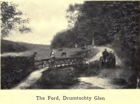
Herscha (725 ft.); and Knock Hill (717 ft.). On the north side of
Strathfinella lies one of the most romantic and picturesque spots in
Scotland, the famous Glen of Drumtochty, leading by the “Clatterin
Brigs” to Fettercairn and the Burn.

Between the Howe and the
coast a lower range of hills, known as the Garvock Heights, cultivated
almost to their summits, runs in a south-easterly direction through the
parishes of Arbuthnott, Garvock, and St Cyrus. Their elevation ranges
from 500 to 900 ft. Johnston Tower (915 ft.), immediately above
Laurencekirk, is a conspicuous object from all points of the compass.
The view from this point is magnificent, comprising hill and dale,
stream and sea, fertile fields and cosy homesteads. The descent from the
Garvock Heights to both the Howe and the sea is gradual, the slopes on
each side being here and there dotted with patches of wood or grassy
moorland which give freshness and colour to a somewhat bare and
monotonous district. East of the Bervie valley a lower range, really a
spur of the Garvock Heights, starts at Carmont Hill (710 ft.), on the
south side of the Carron Water, and is continued, with a slight descent,
over Bruxie Hill (700 ft.) to Bervie Brow (451 ft.), overlooking Bervie
Bay.
When the character of the soils of the county is considered, regard must
be had to the nature and structure of the underlying geological
formation, since the soils are indebted to disintegrated rocks for their
mineral constituents. The quality of a soil, moreover, depends largely
on the upper formation of the neighbouring heights, the decomposed
portions of which are washed down by rain and flood to the lower grounds
and there incorporated in the soil.
The best farming district in the county is undoubtedly along the coast,
especially between St Cyrus and Bervie. The soil here is a deep black
loam. Most of it is free, parts of it tenacious, but none of a stiff,
clayish nature. The farms in the St Cyrus district are undoubtedly the
most fertile in the county. The liberal application of lime from the
lime-kilns at St Cyrus in the beginning of the last century was a
valuable factor in improving the soil ; and this, combined with
intelligent and up-to-date methods of cultivation, is reflected in the
general excellence of the' crops in this district. In striking contrast
are the thin and cold soils of the Garvock region. Owing to elevation,
exposure, and absence of thorough drainage in many parts, the soil
cannot be called a very kindly one, although during the last half
century much has been done to improve the appearance of this somewhat
bare district.

The soils in the Howe of
the Mearns are rather variable, ranging from deep brown soils resting on
the boulder clay, to a light gravelly moorish soil stretching right up
to the middle of the Howe, through part of the parishes of Marykirk,
Laurencekirk, Fettercairn, and Fordoun. In the neighbourhood of
Laurencekirk the soil is a stiff clay, though on the whole a good
cropping soil. The Grampian district, the largest in the county, is
naturally a poor farming district, the soil being neither deep nor
productive. Still, on the clay-slate formation, we find along the
southern spurs of the Grampians a soil remarkably well-adapted for the
growth of timber plantations, which are here very numerous.
The soil on Deeside is of a thin, gravelly nature, being formed from
decomposed schists and granite rocks, with a small proportion of moss or
decayed vegetation. Though not suitable for the production of heavy
crops such as wheat and barley, the soil of Deeside is remarkably
suitable for the culture of small fruits (strawberries and raspberries),
and especially for the growth of timber. Between Deeside and the coast,
in the' district around Muchalls, much of the soil is mossy, while
between Stonehaven and Aberdeen a strip of land, bordering the sea and
extending a few miles inland, is of the same nature. In the
neighbourhood of Aberdeen, part of the land is laid out for the
cultivation of potatoes and vegetables, a ready market for which is got
there.
|

